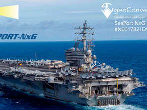
Frontier Geospatial Business Partner Awarded Contract with the Navy
Our business partner geoConvergence received exciting news this July. After lots of hard work they were awarded a spot on the...


WELCOME TO

Frontier Geospatial, LLC is a Geographic Information Systems company established in 2013. We are an experienced team of GIS professionals that focus on our clients. We take a collaborative approach, working hand-in-hand, listening to their needs, and providing advanced technology and the tools to help them exceed their goals.

GIS Data Creation & Editing
Automatic Vehicle Location (AVL)
Web Maps
Database Creation & Analysis
UAV Flights, Data Creation, & Sales


"Frontier Geospatial did an excellent job creating our utility mapping from the ground up. Philip was great to work with and always helpful with updating maps. Great company and would definitely recommend for all your GIS needs."
—